

EarthQuake Map app for iPhone and iPad
Developer: Illés László
First release : 04 Feb 2010
App size: 5.21 Mb
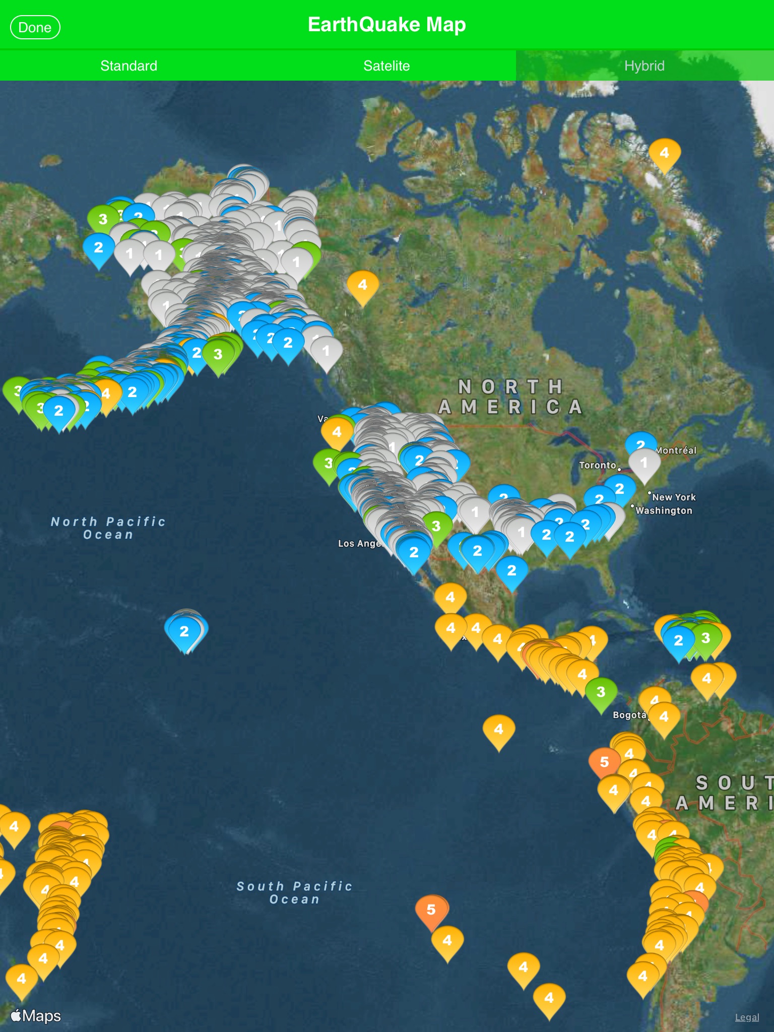
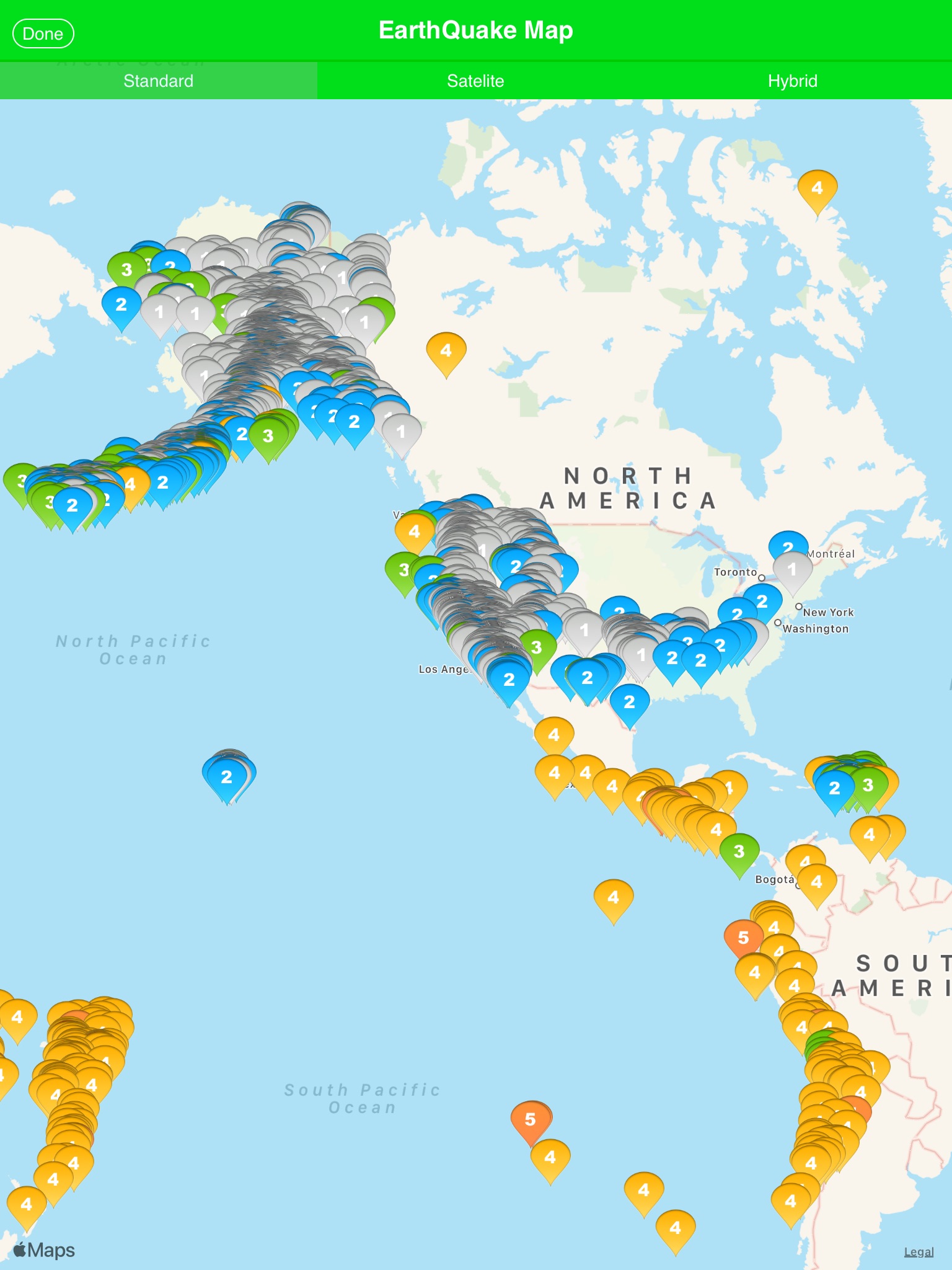
EarthQuake Map is a powerful and intuitive app that displays earthquakes worldwide with vibrant visuals tailored to your preferences. Discover seismic activity effortlessly with the ability to display up to 10,000 earthquakes simultaneously on an interactive map. Perfect for enthusiasts, researchers, or anyone curious about the Earth’s movements!
Key Features:
•Global Earthquake Visualization
Pinpoint earthquake locations worldwide with color-coded markers for quick magnitude identification.
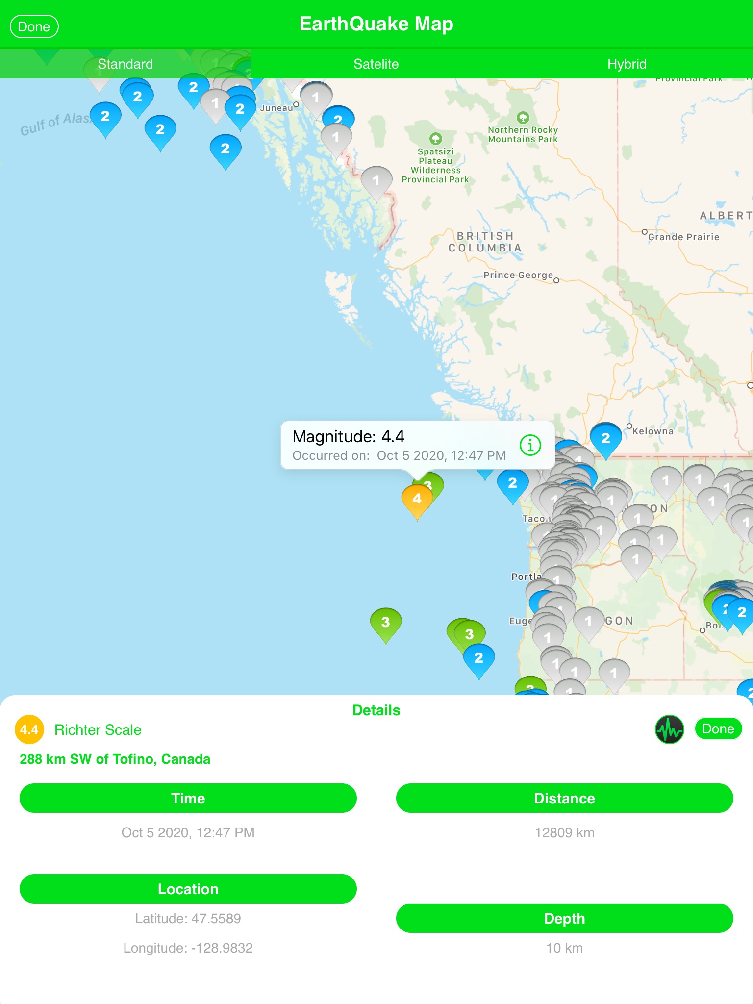
•Detailed Earthquake Information
View essential details about each earthquake:
•Occurrence time
•Latitude & longitude
•Depth
•Magnitude
•Location/place
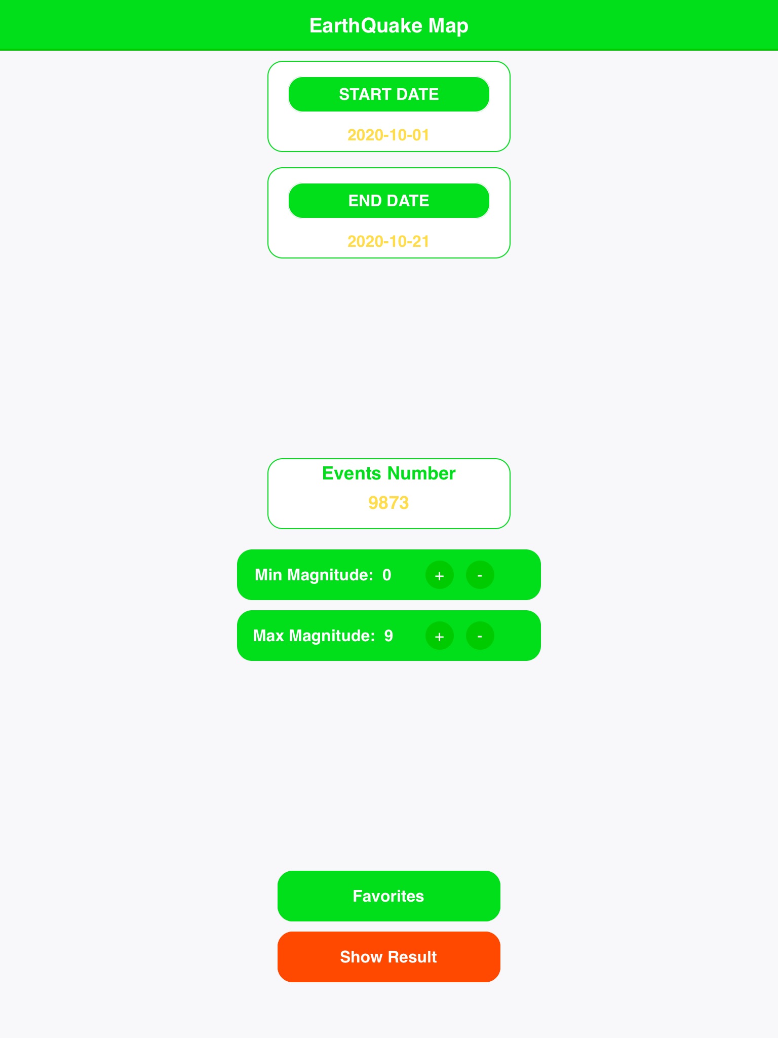
Customizable Settings
Personalize your earthquake search:
•Set a custom start and end date
•Define minimum and maximum magnitude thresholds
Adjust map views for an optimal experience
•Favorites Management
Save important earthquakes to your favorites for easy access
•Delete saved events when no longer needed
EarthQuake Map is the ultimate tool for staying informed about global seismic events in real-time or exploring historical earthquakes. Download now and explore the powerful forces shaping our planet!
Latest reviews of EarthQuake Map app for iPhone and iPad
This did nothing for me. It showed me nothing but dots. It gave me no info. on anything. This is a BIG thumbs DOWN. Sorry, but maybe this will get you up to date like Earth Quake Zone.
Wow, this is really cool. enjoy seeing where they are happening.
Repeatedly crashed on launch. Never did see it do anything!
Should add a lot more features. This is just a map with dots. Also, make the map rotatable without walls.
This is a nice app but what it really needs is the ability to utilize the iPhone accelerometer to detect earthquakes and automatically share that data to the cloud and/or the USGS. Only when enough similar readings are detected from a certain region within a narrow timeframe would the data be considered legitimate and then be pushed back out to the map for all users to view. The app could also be active only at certain times of the day/night that the user defines. As well as only be active when connected to pre-defined wifi networks. Such as Home or work. Another option would be to only take accelerometer reading when it is plugged into power (such as when on your night stand or connected to a computer USB). The app could also use the iPhone GPS to disable sensor reading when moving. As well as only record seismic data when the app detects the iPhone is laying flat on its back. Another option would be to disable the seismic sensor data output when a face is detected with the front facing camera. Requiring the app to be running in the foreground would also further prevent false readings. This could easily, quickly, and cheaply create a huge network of seismographs around the world.